Fun with Google Earth...

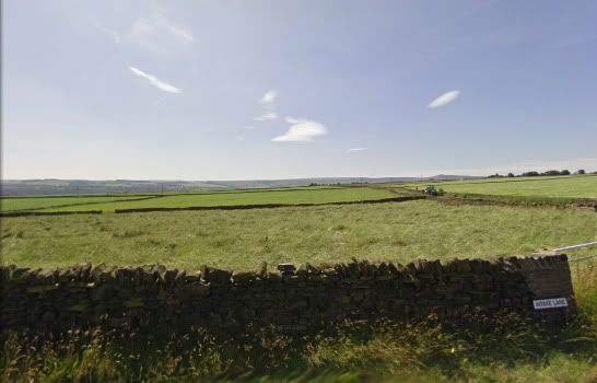
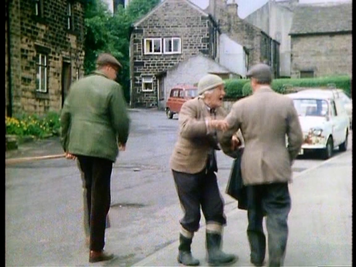
I'm a bit proud of this next filming location finding, because I've been trying to find this one for a few months. The Clothiers Arms from "Deep in the Heart of Yorkshire". I've tried looking all over Holmfirth, looking southward, looking northward and really not finding anything. I've even done a search on GoogleEarth for Clothiers Arms, but ending up with results that didn't seem right. I was starting to think the name of the pub was made up. It wasn't. Also, the only thing I had to really go by was the hill in the distance when Compo stumbles out of the pub. I finally located what I thought was the hill, the next fun part was looking at it from different angles to see if there was a place perched up on the hill like the pub is in the episode.

deep3.jpg

deep4.jpg

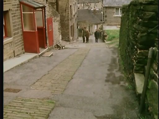
As you see, it was a bit foggy and not really that much view of the hill. So all I knew was a line of trees then some sections where there were no trees.

deep5.jpg

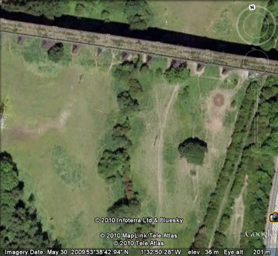
I even tried finding these buildings, thought I was close, looking at a location near St. John's in Holmfirth, but I was way off in comparison trying to find the hill in this same location looking the other way. I JUST NOW found this location..

deep6.jpg

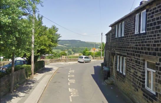
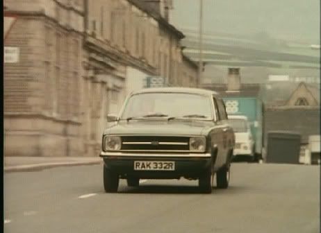
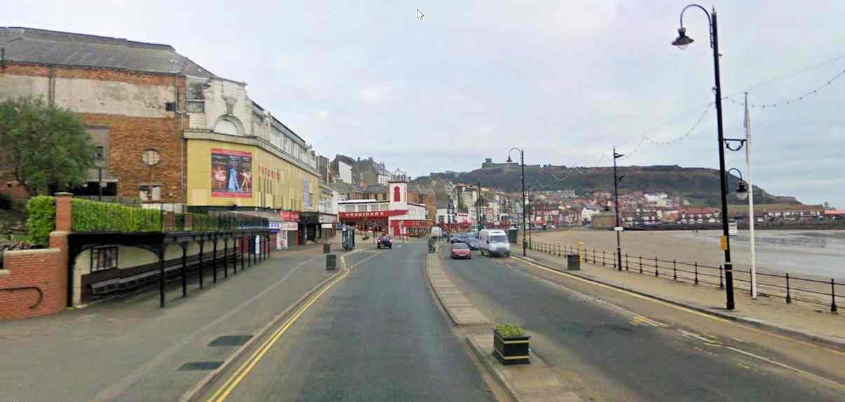
There's the hill in the distance and the clearings on it.. and the street curves the same way here as well.

deep7.jpg

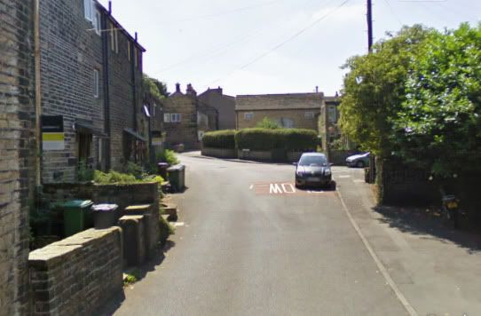
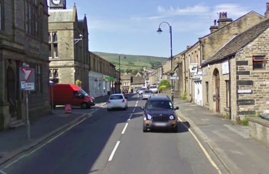
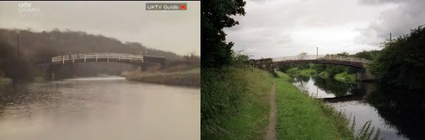
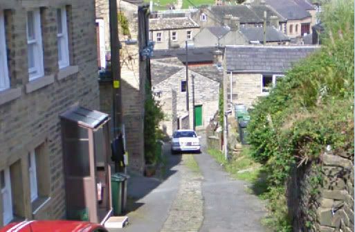
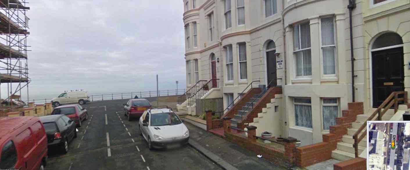
Here's the same buildings with only minor renovations!
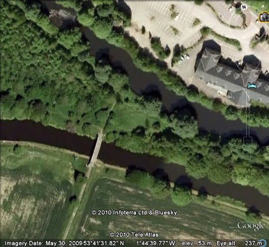
and finally...

deep8.jpg


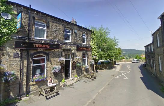
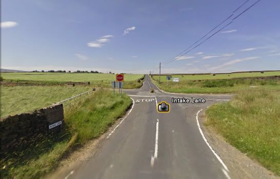
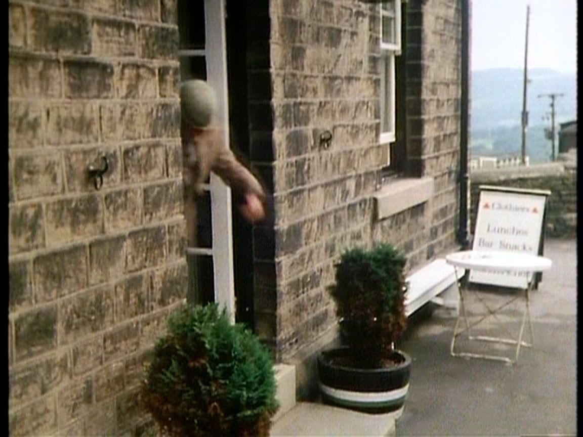
The Clothiers Arms on 71 Thong Lane in Netherthong!

I thought for sure I looked for Clothiers Arms.
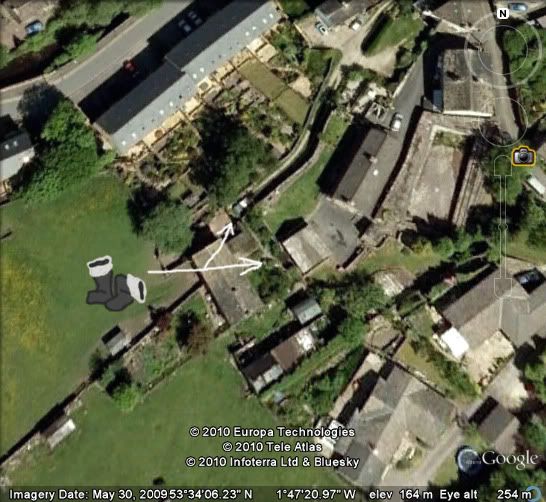
 :eek:
 
Just stumbled across this. Clothiers Arms in Netherthong is the same spot where Compo is following Nora in the opening to "The Prophet According to Bickerdyke". Then at the corner of Thong Lane and Giles Street, just a few feet away is where Nora thinks Compo is following her and swats away with her bag.
 
I have had a googlemaps wander around Scarborough and found the following, inthe Great Boarding Hose Caper this is where they first parked the minibus

Minibus.jpg


This was the B&B they stayed in

B&B.jpg


They went for a walk and after the amusement arcades they appear near the harbour,was this the spot

Walk.jpg


And Finally a picture of the area in Cheering up Gordon,where he was fishing, the google car had not been down here

Walk2.jpg
 
What about where Compo tried to sell ice cream in the episode "The Ice-Cream Man Cometh"...Where he went down the hill out of control and found Howard and Marina... ;D
 
No streetview for "The Ice Cream Man Cometh" but it's on Terry's map section. Dovestone Reservoir in Saddleworth.
 
As for "Greenfingers", I looked at that one on Youtube last night. At first I thought it might be near the Pegden residence, but then I saw in the next scene they're walking where Penistone Road, Sheffield Road, Huddersfield Road and Holmfirth Road meet up together in New Mill. Then in the next camera shot, I think they're on the hill at Royds Ave and Greenhill Bank Road in New Mill, because you can see the church in the distance that is seen in the ending of "Getting on Sidney's Wire" and at the opening of "Elegy for Fallen Wellies". So I'll be looking at a better quality of the episode on my DVD today and looking at that area some more.
 
I stand corrected. I looked at my DVD copy of the episode. When the trio come back by Bickerdyke's you can see a very good view of Holmfirth across the street. Near St. Johns Church. Then the carrot decides to roll down Goose Green/New Row. I looked at this area and saw an area that is down hill (north) of Goose Green/New Row pretty much looks just like the area. I'm pretty sure this might be it. Looks like a private driveway of some sort where the drawn wellies point. ;) Also, if you notice, beside the GoogleEarth camera icon is where the old pool Foggy tries to take the trio to in "Earnshaw Strikes Back". This all is in Holmfirth.

greenfingers.jpg
 
I would suspect that you may well be correct as Holmfirth was very much the focus for filming in the earlier days, and these epsidoes that you mention are really quite early on.

It was abou the tiem of the Seymour episodes that Marsden began to be used more although various other locations had been used particularly Scarborough and the Worth Valley (for one of the all time favourites - Full Steam Behind) and Spurn Point for the classic "All Mod Conned"
 
It's funny that you mention the Marsden area. I decided to check out "Who Made a Splash in Wales" and saw that the garage Clegg, Compo and Sid drive the car from is Beaumont Bros. in Meltham. I'm still working on where the house is of Foggy's lady friend. Placement and stuff makes me want to think Upperthong, but the street I'm focusing on doesn't have a streetview. :/
 
From "Who Made a Bit of a Splash in Wales Then"

wales1.jpg

wales2.jpg


Beaumont Bros. Garage. On Huddersfield Road in Meltham. Just past the building on the left side of the image currently known as The Carlisle Institute. It's not there anymore, looks like some new building development going on with satellite view of it.
 
POSSIBLY from "Who Made a Bit of a Splash in Wales Then"..

wales3.jpg

wales4.jpg


I'm really not sure about this one, other than it seems right on the satellite view of it and with how the scenery looks in the second picture. This is the intersection of Intake Lane/Nopper Road/Black Lane/Arborary Lane between Linthwaite and South Crosland. This is close to the Will's O Nat's which appears in Cheering Up Ludovic. Again, I'm not positive on this one, just things seem to fit together on this one.
 
Not sure if I've mentioned these two before on here or not..

From "Here We Go Into the Blue Yonder".

blue_yonder1.jpg

This is the best satellite view there has been. I was lucky to just stumble across normal pictures of the viaduct to get the name. I then looked on GoogleEarth satellite view and could compare the bushes and the electrical lines and stuff. This is the disused Crigglestone Viaduct beside Denby Dale Road near Calder Grove.

From "The Flag and Further Snags".

kirklees_cut2.jpg

kirklees_cut3.jpg

This is near Premiere Inn Huddersfield North on Wakefield Road between Brighouse and Mirfield.
 
I think you should go into forensics Claye.With your ability I think you could help the police.

In 'Whoops' (and several other episodes) we see Compo Clegg and Foggy discussing Chuffer and how he used to wrestle- I think Doreen Tattersall.I'd like to know where that street is.(It had a house with a red extension on the front door.
 
In "Whoops" the location the trio walk by...

whoops1.jpg

whoops2.jpg


Goose Green, a very famous location/road that turns into New Row. An easy way to tell whether this is Goose Green/New Row is the walkway or road and how it's split into three sections with the middle being cobble or bricked. 8)
 
That's cobble (not brick) so the horse could get
some traction. Kinda behind and above The Nook,
and goes by an old cemetery.
 
Is there any way Claye you could find where Sid's Chip van was parked in Getting Sam Home?When Cleggy complained about it facing the river.
 
George, this one is a tough one because of the development that has gone on in Holmfirth. Though, with the opening scene from "The Bandit from Stoke-On-Trent" where you can see one of those mill chimneys in valley in the background, I have my suspicions that it was located in an area beside and over the River Holme, between Woodhead Road and New Fold. The area between the pub "Jacob's Well" and Nora's where Greenfield Road meets with Woodhead, but on the side of New Fold... Confused yet? lol Basically I think it's the area where New Fold ends heading south.
 
Back
Top